In April 2015, when I was in the early stages of writing Searching for the Lost Tombs of Egypt, I took a little field trip to Saqqara to look for the tomb of a man who, legend has it, was the architect of the first pyramid, a man who became a god and gave his name to a Hollywood bad guy. I was going to look for the tomb of Imhotep.

Imhotep in deified form, temple of Hathor, Deir el-Medina
I had no expectation of finding it of course – a lot of better qualified people have spent much longer than a day trip would allow trying and failing to do so, but I wanted at least to go and have a look at the northern part of the site where, for various reasons, his tomb is thought to have been. The trouble is much of the evidence is completely invisible on the surface, buried under the sand.
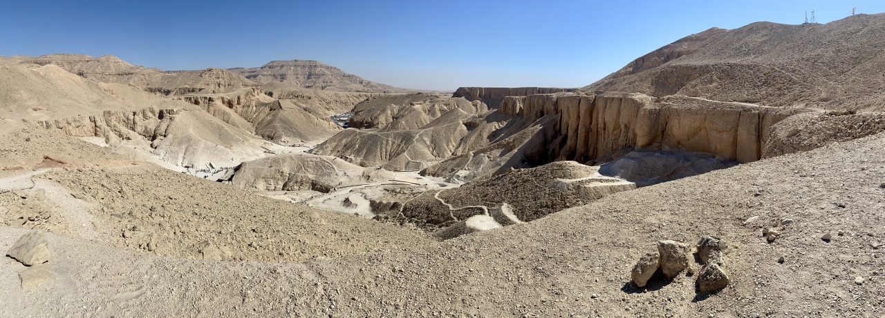
Wandering across the North Saqqara plateau
I was looking for several very large Third Dynasty mastabas in and around the area of the Sacred Animal Necropolis (SAN) which was discovered by Bryan Emery on behalf of the Egypt Exploration Society (EES) in the 1960s and, though little known despite its importance, is visible.

Image of the EES excavations at North Saqqara in the 1960s, looking north west towards the pyramids of Abusir. Courtesy of The Egypt Exploration Society
‘Mastaba’ is the Arabic word for the kind of platform or bench commonly found to this day outside Egyptian houses, where members of the household sit to while away the day or to chat. It’s also the name given by Egyptologists to a particular kind of tomb with a superstructure of roughly the same cuboid shape but on a much larger scale. These evolved out of the simple mounds overlying shallow tombs that constituted the earliest monumental burials in Egypt. By the time of Imhotep and his king, Djoser, in the early Third Dynasty, the grandest were giant, rectangular mudbrick buildings rising to ten metres in height and over fifty metres in length, and incorporating numerous chambers and little niches where offerings could be placed and rituals performed. The bigger the mastaba, the wealthier or more important the individual buried there, we assume.
The largest of a group of five such monuments at Beit Khallaf in Middle Egypt gives you a good idea of the size and shape. There are dozens and dozens like this at Saqqara, some completely unexcavated. There’s an awful lot you can see when you go to the site, but there’s an awful lot more that you can’t.
Mastaba K1 at Beit Khallaf
I wanted to go and get closer to some of the things you can’t see, which I also suspected wouldn’t be well-known even to the local inspectorate, so it was obvious that I was going to have to give some thought to how I was going to find what I was looking for. In the event the trip was very good fun even if it led my two companions to think I was crazy; more importantly it enabled me to take several photos that eventually made their way into the book, and so I thought it might be worth explaining what I did.
Technical preparations (WARNING: the next part’s a bit geeky)
My idea was this: if I could take a smart phone or other GPS-enabled device I thought I ought be able to walk out into a featureless desert and still have some idea of where I was. Furthermore, if that device had a data connection and was able to display my location on a satellite image or map, and if that map could be annotated with the position of the monuments I was looking for, I would be able to say when I’m standing on the spot (as in ‘X marks…’) even if nothing was visible on the surface.
So, first of all, I spent a day or so in the library at the EES poring over the published archaeological maps, then staring with equal intensity at Google Earth to see which, if any, of the main archaeological features at Saqqara I could see on the satellite images. I also did the same thing in reverse, looking for archaeological features in the satellite images and trying to identify them on the maps. To my delight the main temple area of the Sacred Animal Necropolis showed up very well, which was exciting in itself: the SAN is one of the most important sites in the EES’ history – I was Director of the Society at the time – and yet it’s well away from the parts of the site that are frequented by visitors and I had never been. I knew that two of the most important mastabas for my search, numbers 3510 and 3518, lay in the same area. One, 3518, was very visible in the satellite images so I was able to drop a virtual pin onto that location; 3510 was totally invisible however.

Satellite image annotated with the approximate locations of various archaeological features (as far as I could identify them…). Explore the map here
The structures that weren’t visible, at least not clearly, were more of a challenge. In those cases I had to improvise. It wasn’t the most scientific of methods but I came up with the idea of re-sizing the satellite image to the same scale as that of the published maps, and then, using the scale given on the latter, measuring the distance from something visible on both, e.g. SAN, to the mastaba I wanted to locate, and transposing the invisible line between the two from the printed map to the satellite image. I then dropped another virtual pin onto the satellite image at the appropriate spot, having again squinted even harder at it this time looking for suspiciously rectangular shadows. Not the most accurate way of doing things perhaps but I thought it would give me a decent chance of identifying any vaguely visible mudbrick on the ground that might have been part of what I was after. I also knew that in case where there really wasn’t anything visible at all, precise accuracy wouldn’t be that helpful anyway, as there still wouldn’t be anything to see, but knowing I was in the right area, close perhaps, would be enough.

My somewhat unsophisticated(…) way of transposing now disappeared monuments marked on paper maps onto a satellite map on my laptop screen
The result of all of this was the map you’ll find here, and this is what I took with me to Saqqara. Once I arrived in Egypt, however, I realised there would be a few further technical obstacles to overcome. Firstly, for some reason, maps like this one, although created in Google Maps via a web browser, could not at the time be viewed in the Google Maps app for iOS, meaning I would not, as I had hoped, be able to open the map on my iPhone / iPad and simply watch myself as a blue dot wandering towards the virtual pins on the map. In order to track my movements I would instead need to open the map in a web browser, which would allow me to see where I was in relation to any landmarks visible in the standard version of Google Maps, but not my custom map with the important locations marked. I decided the best I could do would be to take screen grabs of the annotated map while online, and then flick between the two – Google Maps to see where I was, and the screen grabs for comparison with the location of the archaeological features once I knew I was in the right area. Then of course I could start to look for evidence of the features on the ground – any mud brick peeping through to the surface etc.
As a backup, I also bought a GPS unit for my camera which I had hoped would allow me to pinpoint my exact location of each photo I had taken once I was back at my desk. On-site I would use my iPad (bigger screen than an iPhone, easier to see though not that easy in very bright, direct sunlight…) to get me as close as possible, and the location of the photos to check once I was back at home and online.
To the site
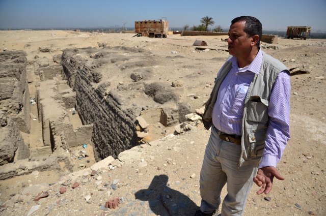
And so, in April 2015 I set off for Saqqara with Essam Nagy of the EES’ Cairo Office. On arrival we were warmly welcomed by colleagues from the local Ministry of Antiquities inspectorate. Mohamed Youssef Morsy showed us an Archaic Period mastaba close to the southern end of the North Saqqara plateau which he had recently excavated. Following this another member of the inspectorate, Tamer Radwan, accompanied us on our mission to try to find the locations I was looking for.
Mohamed Youssef Morsy who showed me the site of his recent excavations
A number of the archaic mastabas are still very visible along the edge of the escarpment overlooking the Nile Valley, which was very encouraging.

One of the Archaic mastabas still visible along the escarpment edge, overlooking the Nile Valley
Wandering northwards across the desert, the Main Temple Complex of the Sacred Animal Necropolis was easy enough to find which was quite a thrill.
The main temple complex of the Sacred Animal Necropolis
This would have been a very sizeable and busy area devoted to the maintenance of the cults of various gods in the form of sacred animals – ibises, baboons, falcons, cows and others – mummified examples of which were buried in huge numbers by visitors hoping to gain the favour of these deities, in the vast network of catacombs the ancients cut out of the bedrock underneath the plateau. Emery’s excavations revealed not only the catacombs, mummies, and temple area but a vast quantity of material shedding light on all aspects of life from the Late and Ptolemaic Periods during which the site was in use. Despite the importance of the site it is little known and hardly receives any visitors now, which added to the thrill of course.
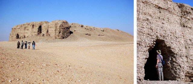
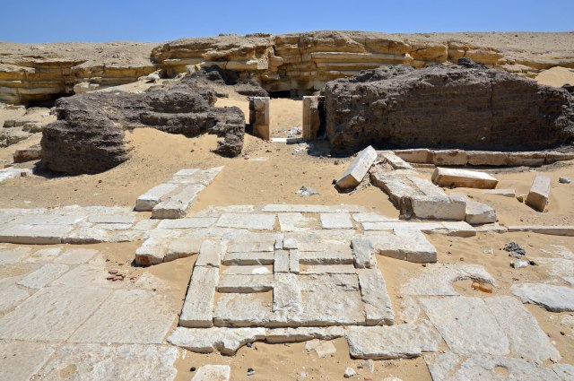
Mastaba 3518 is quite close to the Main Temple Complex and was also quite easy to see, a huge mass of mudbrick emerging from the sands.

The remains of Emery’s mastaba 3518, emerging from the sands
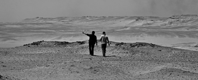
I was much more reliant on the satellite maps to locate 3510 but I was satisfied that I had come close enough to this one and two further mastabas which it has been claimed may be potential candidates for Imhotep’s tomb but are totally invisible having only ever been spotted in an image of subsurface remains produced by a geophysical survey carried out in the early 2000s.
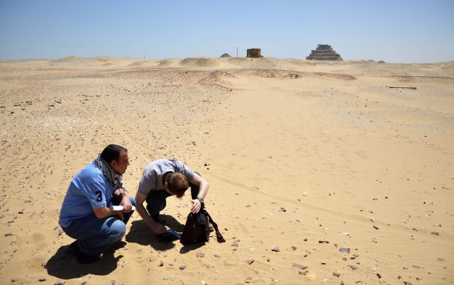
Attempting to locate mastaba 3508 of which nothing appeared to be visible on the surface. Bright sunshine made viewing the satellite maps a little difficult…
The brief survey complete, Essam and I took the opportunity to visit ‘beit Emery’ the house built by the great excavator and continued to be used by EES teams until it was passed over the Ministry of Antiquities for use as a storage facility a few years ago.

Essam outside ‘beit Emery’ the house built by the great archaeologist in which he lived during his ‘quest for Imhotep’
Along the way we found some of the light-gauge railway cars he and other archaeologists used to carry vast quantities of debris away from their excavations. They were just dumped near the house he and later EES teams lived in, and had started to disappear beneath the drift sand, rapidly becoming yet another layer of the history of the site.

The full story of Emery’s ‘quest for Imhotep’ forms the first chapter of Searching for the Lost Tombs of Egypt which will be published by Thames and Hudson on 11 October 2018 (pre-order here). The photos I took during the trip are here (Facebook), and displayed with their precise positions on the map, here (Google Maps).

Hi Chris, thanks for this rather exciting report! As a trained historian who ended up in computer science (…) I recently started to study ancient Egyptian history as a hobby, and was surprised to find that so many promising sites have hardly or never been studied – no doubt partially because of lack of funding and/or local politics, which seem to be a continuous hurdle for professional teams in Egypt and from around the globe. I wanted to comment on your map, as I wonder why you skipped or may have missed out on some pretty large structures which appaear in the middle between the famous Serapeum and the Abusir complex – they are more or less clear to see in Google Maps at e.g. 29.884136966019, 31.20886049031227; 29.882776131243414, 31.209797637147766 and 29.88276537348172, 31.21112493291379 – if I enhance the area pictures with some sharpening or outlining filters they are even more clear to see. If you ever consider to go back and go these particular sites, consider to contact me and I might be joining you. Will read your book and articles a bit more, you got my attention….
Hi Rob, Glad you enjoyed the post! The reason for not including any other structures in the map is that, as the description in Google Maps says: “Significant archaeological features referred to in Chapter 1 of Searching for the the Lost tombs of Egypt”. there are of course many, many other archaeological features in the area but to try to show them all would make for a map that is very complicated and difficult to read!
Understood, thanks. Well, hopefully that area does not contain Imhoteps tomb then :-). If I learn more about it – I contacted an expert friend from Leiden University abouy the same – I’ll let.you know. Thanks.
Thanks Rob! I suspect that most of the structures you can see were among those excavated by Bryan Emery, mostly in the 60s, and also by others, but there are plenty of other tombs in the area that have been excavated and others that haven’t! There’s a lot more in my book 🙂
Pingback: Searching for the Lost Tombs of Egypt – Nicky van de Beek